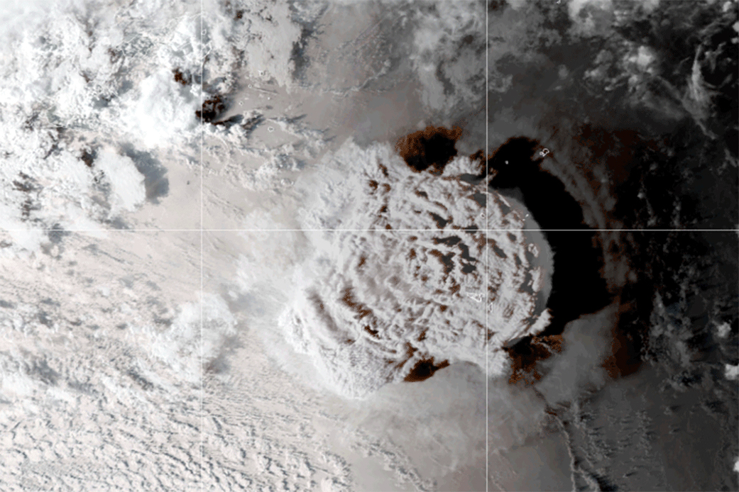
The Tonga (Hunga Tonga-Hunga Ha’apai) underwater volcano that erupted on Jan. 15, 2022 may have caused unusual weather patterns and heavy rainfall around the globe in 2023. The underwater eruption in the South Pacific Ocean threw unprecedented amount of sea water into the stratosphere. According to NASA, the now extra water vapor high up in the atmosphere is equivalent to 58.000 Olympic-size swimming pools or equal to 10% of the water already present in the atmospheric layer.
The 1991 Mount Pinatubo eruption in the Philippines also sent water vapor into the stratosphere but the Tonga eruption sent nearly four times more of the amount of water into the atmosphere scientists estimate. The excess water vapor injected by the Tonga volcano could stay in the stratosphere for several years and influence atmospheric chemistry. It could temporarily accelerate depletion of the ozone layer and affect surface temperatures with a small temporary warming effect (because water vapor traps heat). These effects would dissipate when the extra water vapor cycles out of the stratosphere and into the troposphere where near weather systems and rainclouds are formed..
Tonga eruption video (and explosion audio): Link
In my thinking, this enormous volcanic eruption must be able to change normal weather patterns and give quite a bit more precipitation than usual. If NASA say it will stay for several years before it cycles out from the stratosphere and into the troposphere, we can expect a lot of unusual weather patterns and a lot of precipitation the next coming years. This will not go away very soon.
Heavy rainfall in Northern Europe and Scandinavia breaks all records
If the excess water vapor cycles out of stratosphere (atmospheric layer 11 to 50 km) and into troposphere (atmospheric layer 0 to 10-18 km) our weather surely will be affected by it. The extra water vapor in troposphere where the most cloud types is located would probably cause an increase in clouds and heavy rainfall (or snowfall).
I am no climate expert or meteorologist but I know water vapor in the end can form a cumulonimbus or nimbostratus cloud that can rain. And then you have a sudden increase of water vapor in the troposphere that can condense to liquid water, more rain than average would be the result. And the many heavy rainfall in Scandinavia, Europe (and the rest of the world) in 2023 strangely breaks all records.
Netherlands had an unseasonable amount of rain in July and the beginning of August. July was wet with precipitation almost every day with an average of 110 millimeters of precipitation over the country compared to the normal 78 millimeters, On average, it also rained significantly more than usual, with 61 hours of precipitation against a climatological average of 40 hours. It was wettest in the northeast and east of the country, with 100-130 millimeters on an extensive scale and locally even more than 150 millimeters in parts of Friesland and Drenthe.
The precipitation in Netherlands on August 9th 2023 shared by Reinier van den Berg on Twitter shows up to or above 100 mm rain.
De wellicht natste week van de zomer is nu echt begonnen. Het wisselvallig weer houdt nog minstens tot halverwege volgende week aan. Hieronder de totale neerslag in 10 dagen tijd (ECMWF model) voor NW Europa (inclusief de Alpen) en de Benelux. Indrukwekkende hoeveelheden. pic.twitter.com/qXVmtE5Djc
— Reinier van den Berg (@weermanreinier) July 30, 2023
Italy must have experienced some very heavy downpours too on August 9, 2023 (according to the weather illustration above right). The dark gray fields over northern Italy suggest rain in amounts close to 200 mm. In my search for rainy weather events in Italy, I indeed found this article from August 14, 2023. They also had extremely high rainfall levels in May 2023 that led to severe flooding in Emilia-Romagna. It was a one-in-200-year extreme weather event – 17 deaths and 50.000 displaced people. Rain levels were “very unusual”. Source link
Germany precipitation measured for spring 2023 was 196.7 mm, which is 25.3 mm (or 14.8 %) more than the average over the period 1991-2020. And 10.8 mm (or 5.8 %) more than the average over the reference period 1961-1990 (DWD). July precipitation were nearly 30 per cent more than normal precipitation for the reference period 1961–1990 (DWD).
Denmark had several heavy rainfall through July and August. According to DMI, July 2023 featured more than double the amount of precipitation compared to what normally falls during the month of July, Nationally, it amounted to 140.8 mm of rainfall in total and it hasn’t happened since 1931. According to the climate normal for 1991-2020, 65.8 mm normally falls in July. August 2023 was the wettest August in 9 years with 101,9 mm of rainfall.

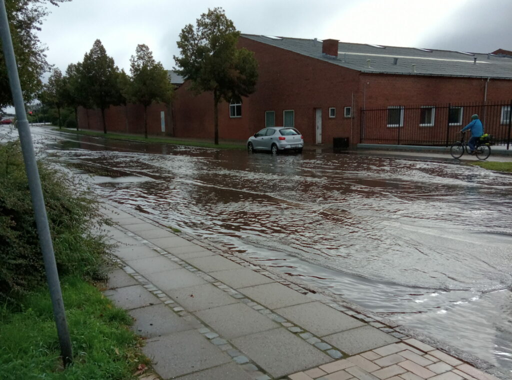
On August 12, I had to go down into the basement for the second time in two weeks and remove 10-12 buckets of water after a heavy and prolonged downpour. The picture above is from Denmark in Odense city and shows Toldbodgade outside Odense Marcipanfabrik filled with rain water. However, minimal in comparison to what they have received from precipitation elsewhere
Norway rivers rose to their highest levels for decades after heavy rainfall that meteorologists said resulted from unusual weather patterns. A hydroelectric river dam collapsed and forced thousands of people to higher grounds and a train was derailed because of washed away tracks. (Reuters)
Extreme rainfall in Southern Europe breaks the record
At the time of writing September 6th, Greece and Bulgaria are experiencing large amounts of rainfall. A region in Greece experienced heavy rain for an entire day resulting in flooding. Severe weather, dubbed Storm Daniel, began on September 5th, 2023. By the afternoon of the same day, the storm dumped 645 mm of severe rain in Zagora in Magnesia, Thessaly. Climate Crisis and Civil Protection Minister Vassilis Kikilias said this was the highest daily rainfall total ever recorded in Greece.
Authorities in Bulgaria declared a state of emergency in the worst affected area Tsarevo on the Black Sea. Overflowing rivers destroyed roads and bridges in the region and a video captured buildings being ravaged and cars being swept out to sea. The amount of heavy rain the southern coast of the country received in a 24-hour period from the storm front “Daniel”, was three times the amount of rain it would normally receive in a month The torrential rains in some places came after a summer of parched conditions, and meteorologists have called the extreme rainfall highly unusual.
Source: floodlist.com, nytimes.com
Torrential rain around the globe
Hong Kong hit September 9th 2023 with heaviest rainfall since records began 139 years ago. It gave 158.1 mm in one hour causing flooding disrupting road and rail traffic.
The Burning Man festival in Nevada desert which is held August 27 – September 04, 2023 drowned in heavy rain and flooding by the summer storm Hillary. 70.000 attendees stranded at the festival which had become a large area of mud. Due to mud, it was very difficult to get away from the festival by car. A lot of people had to walk out of the area, which was pretty difficult too. It has rained on Burning Man Festival before but normally it dries out quickly. This time it rained for several days.
After making landfall in Mexico August 20th 2023, tropical summer storm “Hilary” crossed into California where it is unleashing heavy rain and turning roads into gushing streams. Officials warned of potentially deadly floods. “We are not used to this level of precipitation. Certainly not in the middle of summer,” ~ San Diego Mayor Todd Gloria told CNN
Turkey experienced flash floods that struck northern districts of Istanbul on September 5th causing widespread damage to buildings and roads. In Kırklareli Province in northwestern Turkey, flash floods swept through areas near the Iğneada of the Demirköy district.
Libya was hit on September 10, 2023 when the summer storm Daniel reached a peak in northeastern Libya. Torrential rains between 150 – 240 mm caused flash floods in several cities. In Al-Bayda they recorded the highest daily rainfall rate of 414.1 mm. Libya´s National Meteorological Centre said this was a new rainfall record. This was a terrible catastrophic weather event with thousands missing or believed dead. WMO
New York City September 29, 2023 – a week of nearly steady rainfall caused flash flooding to New York City. The subway was disrupted and rivers of water moved through the streets. New York Governor Kathy Hochul declared a state of emergency for New York City, Long Island, and the Hudson Valley. It was New York’s wettest September on record, with 349 mm of rain falling during that month. The record was set in 1882 when 427 mm fell in September. Reuters
I will continue to update this article with those specific rain record weather events. We have been warned on what´s coming…
We now have November 18th 2023 and I have not observed more news about heavy rainfalls breaking any records. In terms of unusual weather patterns and heavy rainfalls, it has been quiet for a while now. The question is whether there is more excess water left up there waiting to come down?
We have a climate emergency with torrential rain (and snow)
We have a climate emergency, not because of carbon dioxide or the human race, but because of a volcanic eruption Jan. 15th 2022. I am worried about the winter period – if we get as much precipitation in the form of snow this time of year, it could cause major problems for traffic and infrastructure. Areas that normally get snow during the winter period may risk getting much more snow than usual.
Globally, we are indeed entering a warmer period after the last ice age. And the anticipated high temperatures in the world’s oceans today may contribute to worsening storm systems that are intensifying faster than before. The whole thing has probably worsened even more after Tonga’s volcanic eruption. With the extra amount of water vapor in the stratosphere sprinkling down as water vapor and moisture into the troposphere around the globe, these storm systems are sure to deliver much more precipitation than normal.
Again, I am not a meteorologist or climate expert, but it is pretty clear to me what is going on. Heavy rainfall around the globe all breaking the records is highly unusual. And when you look back and find the Tonga eruption injecting 10% more water into the stratosphere. I will put it this way – the sea water that was thrown up into the sky must come down again and it will happen over time. NASA says several years. Perhaps you, as climate expert or meteorologist, have a more complex explanation for the many heavy downpours? But after all, what goes up comes down…
Image credit: NASA

